8
FOR SUPPLEMENTAL INFORMATION
• Maps and ortho aerial*
Stand outlines on ortho aerial
Stand outline map
Land use map
Topographic map
Ownership map
Land aspect map
Timber volume by acres
• Phase I Environmental Site Assessment
• Zoning
• Copies of grazing leases
• Preliminary title report
• Bid form and instructions
• Purchase and sale agreement
* All maps and reports provided by Atterbury Consultants, Inc. use
GIS Acres, and are not legal in reports and in maps.
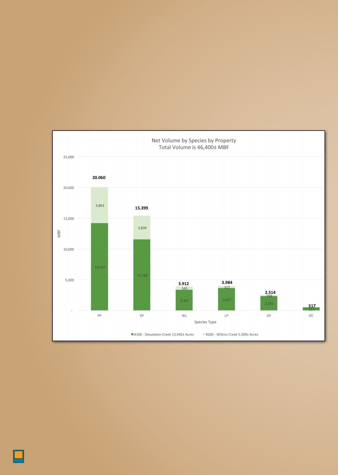
N V By Sp
There is a total of 46,381± MBF with 43% ponder-
osa pine, 33% Douglas-r, 9% western larch, 8%
lodgepole pine, and 6% grand r and other coni-
fer. Desolation Creek contains 77% of the volume,
and has a higher percentage of western larch,
grand r and lodgepole pine.
*
*Source: AƩerbury Consultants


